I was pretty excited to learn this week about Domesday Reloaded. The Domesday project aimed to take a snapshot of British life in 1986. 25 years on, the BBC are looking to update it to document the changes that have taken place since then.
I have been interested in the Domesday project for a while. The idea that a snapshot of Britain was taken, in the form of maps, photographs and text. Yet, the data was unavailable to most people.
The Domesday project was as much an ambitious experiment with technology as anything else. The technology was just about available, but a lot of pioneering work had to be done, and the hardware required for it was prohibitively expensive, leaving many of the contributors somewhat miffed.
Since then, it has become one of the most famous examples of digital obsolesence. This was due to a combination of the technology required to read the discs becoming increasingly rare, and idiosyncratic code.
The Domesday project came at a time when the technology was available, but the standards were not yet there to make it stable enough for long-term preservation, or even easy access in the short term. It’s a reminder that digital technologies are hugely enabling, yet frighteningly fragile.
Then there are the copyright issues surrounding both the content and the technology.
Joys of browsing Domesday Reloaded
The BBC should be applauded for finally managing to open up some of the data to the public on the web. The Domesday project was created before the web was invented. This isn’t how the content was designed to be viewed, so navigation is a bit cumbersome.
But aside from this gripe, the Domesday Reloaded website is turning out to be a fascinating resource.
I was born in 1986, the same year in which the Domesday project disc was published. So the Britain described here is a place that I don’t remember. But enough of it is familiar for it to feel incredibly relevant to me. It’s almost like being given a little upgrade to my memory, so that I can have snippets of knowledge from just before I was born.
Take the photographs for D-block GB-328000-690000 — the centre of Kirkcaldy, my hometown (D-block being one of the 4km by 3km areas the UK was divided into). It took me a little while to recognise “Kirkcaldy’s busy High Street”. But once I spotted British Home Stores, I was right there.
Yet, despite the familiarity, it is almost a completely different world. My memory of the High Street before it was pedestrianised is very limited. But it is just within touching distance of my memory for me to feel a strong connection with it.
The text entries are also fascinating. Most of the contributions were provided by primary schools. A decision was taken by the Domesday project not to edit the contributions, so the quality and style of writing varies from area to area.
As such, what strikes me the most is that it informs you as much about the prejudices of the school pupils and their teachers as it does about the area. It also retains their poor spelling and strange grammar.
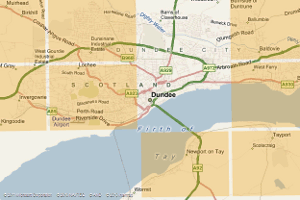
For instance, an entry from Dundee (D-block GB-336000-732000) called ‘Traffic in and out’ is a basic survey of vehicles travelling on a road, with guesses as to where the vehicles are going and why. It lacks the academic rigour you would ideally want from a historical document.
But while some of the entries may seem banal, it was designed to be this way. The aim was to genuinely document society by capturing childrens’ curiosity with everything. This way it wouldn’t leave out what adults perceive as being obvious, when it wouldn’t necessarily be so obvious to someone in 1,000 years.

The really big shame is that not every part of Britain was documented. I could understand remote rural areas not being included. But sadly some highly populated areas have also been missed out. For instance, two D-blocks that cover the centre and east of Dundee lie blank, as does much of London.
But what exists is a joy. Even in the little amount of scanning I have done, I have already learned new information about the area I live in, which has set my mind racing and inspired me to investigate further.
Challenges for the modern day equivalents
What also struck me is how we actually already have readily-accessible modern-day equivalents of the Domesday project, almost by accident. The BBC is asking for users to update the content for D-blocks that were documented in 1986, to take an equivalent snapshot of 2011. I may go out and take some photographs for that.
But this sort of local information is staggeringly well documented already. We have Wikipedia, which can be edited by anyone but retains an academic approach that the Domesday project lacked. As such, it is a treasure trove of local information that can probably be relied on more.
Meanwhile, Google Earth and Google Maps provide masses of images of all corners of the country. It absolutely dwarfs what’s on Domesday Reloaded.
But the big question, which can’t be answered at the moment, is whether the wealth of information available on the web can be packaged up into a Domesday-style snapshot and preserved forever. The challenges of web preservation are massive.
Like the Domesday project, we could find the digital information almost slipping through our hands. The BBC know that themselves. With a stroke of a pen, it was decided that a significant chunk of British web heritage will be removed when the BBC removes some of its archived pages from the web.